California
California is almost twice the size of the United Kingdom and its landscape is vast and varied, ranging from desert to snow-capped mountains, from remote beaches to sprawling cities.
The virtual tours and panoramic images displayed here will give you an insight into the amazing geographic diversity of California. Featuring the lowest point in the United States, Death Valley and Yosemite National Park, a world heritage site.
-
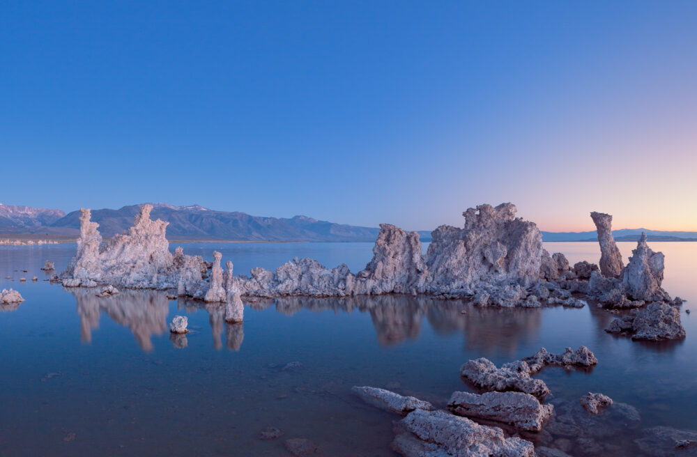
Mono Lake California
Mono Lake Dawn I shot this Mono Lake California 360 at dawn, before the heat of the day where the flies become bothersome and the smell starts to rise with the sun. At this early hour the lake is deserted and especially eerie. The water seems unnaturally calm. The light just tinges the limestone rock…
-
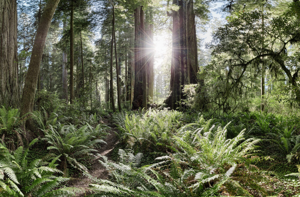
Humboldt Redwoods State Park 360
Humboldt Redwoods State Park From the moment that we learn as children that there are trees through which you can drive an SUV, or whose stumps have hosted a dance floor, the magic of the redwoods is instilled in us. Shooting in 360 really gives you the chance to appreciate these giants. You can wonder…
-
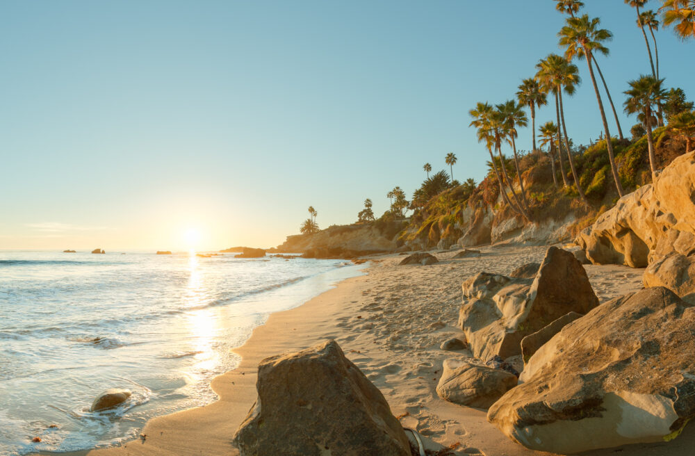
Laguna Beach Sunset
Laguna Beach 360 Who wouldn’t want to be a Californian, watching the locals paddle boarding in the sunset on Laguna Beach? Laguna Beach hosts one of the world’s longest running surf contests. Though, on the evening I shot this, surf wasn’t up. However, watersports definitely weren’t out, and a clutch of paddle-boarders took to the…
-
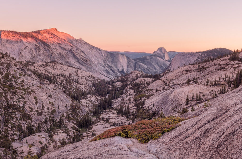
Olmstead Point 360
In this Olmstead Point 360 you can explore the incredible views across Tenaya Canyon to the north side of Half Dome. As you look towards Half Dome, on the left you will see the mountain known as ‘Clouds Rest’. Though the summer weather and glorious sunset didn’t offer any resting clouds on this occasion. You…
-
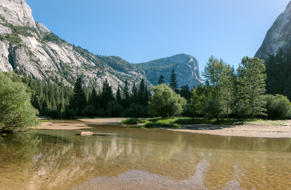
Merced River, Yosemite National Park 360
Yosemite National Park 360 – On the Merced River The Merced River in California runs for 145 miles from the Sierra Nevada down to the San Joaquin Valley and is responsible for the shape of Yosemite valley today. The river was part of the California Gold Rush, with Americans panning for gold in hope of…
-
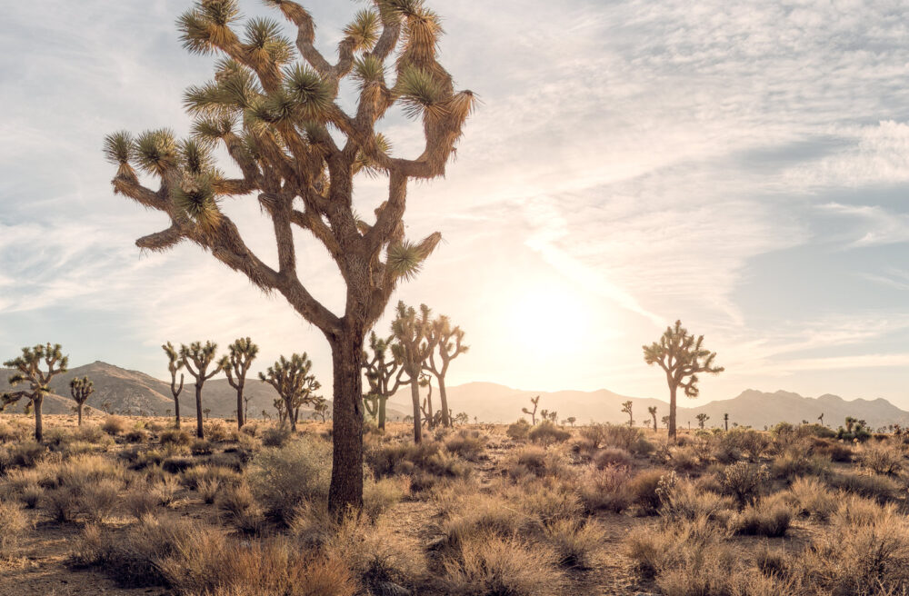
Sunrise at Joshua Tree
Here you can explore a Joshua Tree 360. This was captured at sunrise around the solstice, with the surrounding Joshua trees casting long shadows on the desert floor. Where two deserts join, travellers are met by a landscape peppered with fantastical trees. “Their stiff and ungraceful form makes them to the traveler the most repulsive…
-
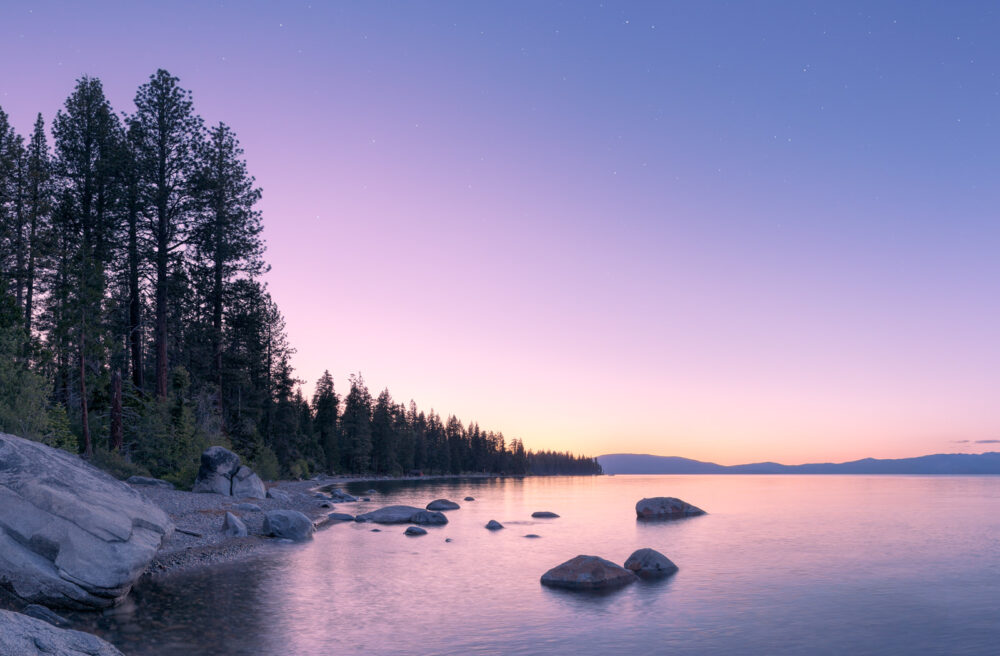
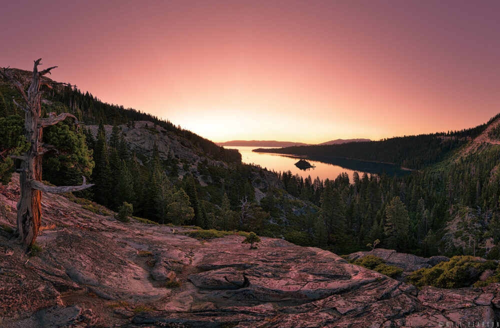
Lake Tahoe Twilight
Lake Tahoe 360 at Twilight Lake Tahoe is famed for its skiing in winter and its beaches with crystal clear water in summer. This makes it an incredible location, but one in which it can be tricky to find an uninterrupted view. This is key when you’re shooting a 360. I got to this spot…
-
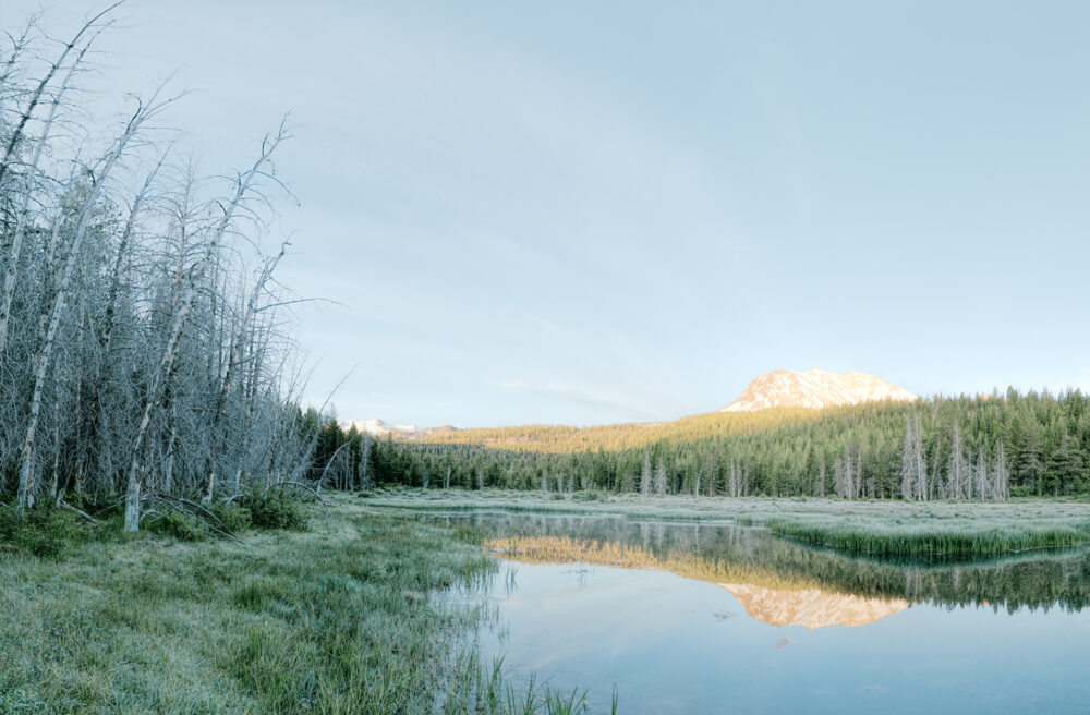
California 360: Lassen Volcanic National Park
California 360 Photography Lassen Volcanic National Park is in the north of the state, far north of San Francisco and Sacramento and about as far removed from them as you can imagine. It has been kept, as far as possible, as a wilderness park, with nearly 90 percent designated as wilderness under the 1964 Wilderness…
-
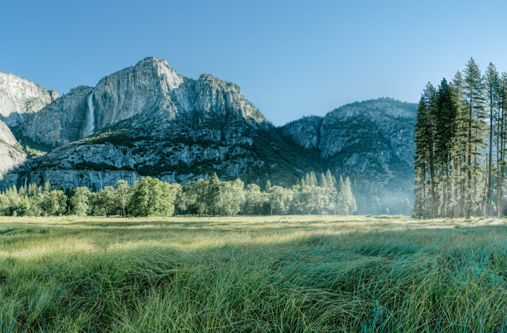
Yosemite Landscape Photography: Cook’s Meadow
Yosemite Landscape Photography Cook’s Meadow offers views around some of Yosemite National Park’s most famous features. Scroll around the Cook’s Meadow 360 to see Yosemite Falls (one of the world’s tallest waterfalls), Half Dome, Sentinel Rock and Royal Arches. Shooting in Yosemite Depending on the project, I normally shoot alone, or just with an assistant.…
-
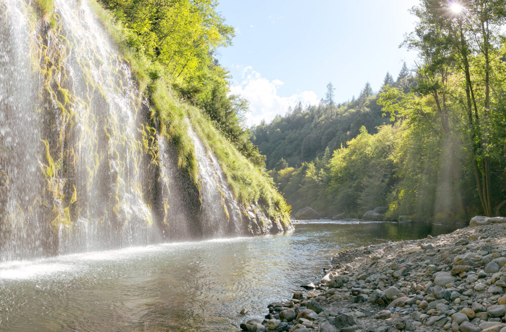
Mossbrae Falls 360
Photographing California: Mossbrae Falls 360, Shasta Cascades Mossbrae Falls is an incredible sight. A waterfall that cascades not just tall, but wide – about 175 feet wide (53 metres). It’s in Northern California, in the Shasta Cascades area, not far from Mt Shasta. You can explore the Mossbrae Falls 360 by scrolling around with your…
-
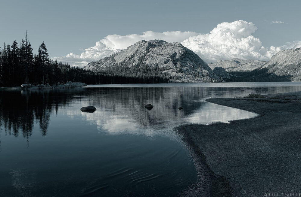
Tenaya Lake: California
If you visit Yosemite between May and November, you can reach the mile-long Tenaya Lake via the Tioga Pass Road. Outside these times, the weather conditions close the road. It is just these kind of extremes that helped form this stunning lake, created by the same glacier that forged Half Dome. Tenaya Lake wasn’t on…
-
Lake Tahoe
“Surely the fairest picture the whole world affords” said Mark Twain of Lake Tahoe, and when free of the crowds you can see just why. This 360 view looks out above Emerald Bay, over towards Eagle Falls (waterfall) and Fannette Island. We had sat out on the rocks, having a beer or two the night…
-
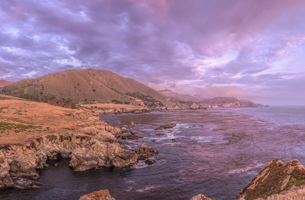
Highway 1 California
Highway 1, State Route 1, Pacific Coast Highway, Shoreline Highway. Whatever you call it, it is (with the possible exception of Route 66) the world’s most famous road. And with good reason – the scenery is magnificent and the route from Orange County in the South, through Los Angeles, Big Sur, central coast, Monterey, San…
-
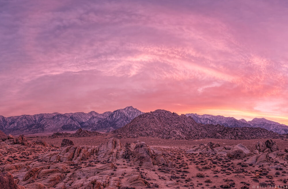
Alabama Hills: Sunset
Having weathered the storm I captured this sunset later on the same day. You can see the stormy clouds over the Alabama Hills in an earlier shot taken from the same location.
-
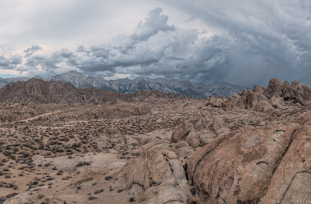
Alabama Hills: Thunder Storm
Arriving here after a drive along Movie Flat Road you quickly understand why this area has become a favourite location for many filmmakers. The rugged, barren and geologically diverse landscape can be seen in hundreds of films, from classic westerns like The Lone Ranger to more recent films, including Iron Man and Gladiator. The Alabama…
-
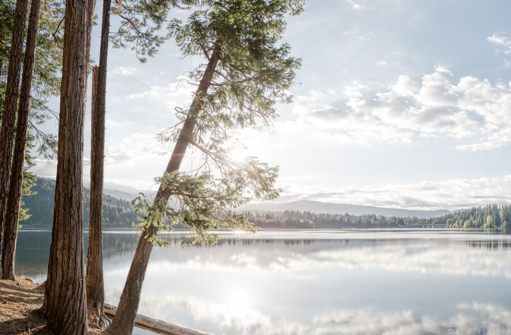
Lake Siskiyou, California
The richly diverse landscape of California is a photographers dream. The night before taking this shot we rolled up in the dark and booked ourselves into a log cabin by the water, not knowing what to expect. The next morning we got up early to discover we’d hit gold with this majestic scene. The morning…
-
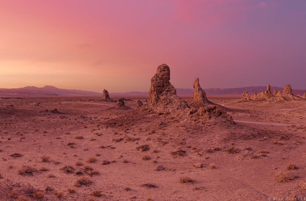
54.4˚C at Trona Pinnacles
I knew it was going to be a hot day photographing the Trona Pinnacles in the Mojave Desert, Southern California, but I hadn’t anticipated quite how hot. We clocked the temperature at 54.4C (130 F), only a couple of degrees centigrade off the all-time world record temperature (56.7C or 134 F), registered at the Furnace…
-
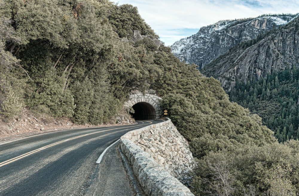
Yosemite National Park
High resolution panorama shot in Yosemite National Park, California, picturing a road tunnel in the mountainside above a deep valley. Panoramic stock photography available.
-
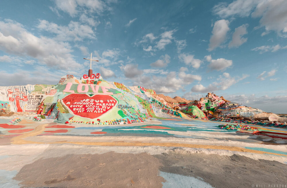
Salvation Mountain, Niland, USA
Leonard Knight started to build ‘Salvation Mountain’ in 1984. Constructed entirely from adobe, paint and window putty with oddments of found objects, it rises out of the barren desert landscape as an incredible example of Folk Art. Sleeping in a truck on site, Leonard is constantly adding to the mountain to help spread the message…
-
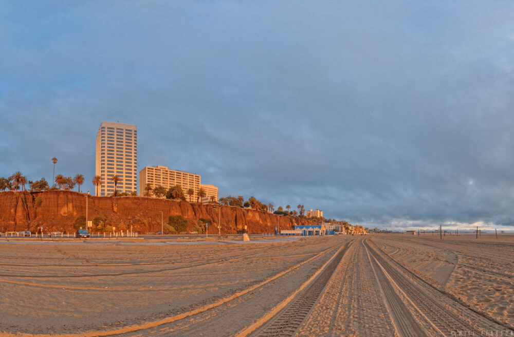
Los Angeles Beaches
Tour Los Angeles’ Pacific coastline virtually with this set of 360 panoramas of some of the beaches around Los Angeles.
-
The Devil’s Cornfield, Death Valley
Death Valley is a place of extremes. In the USA it holds records for these extremes: the hottest place (134°F / 56.7°C), the lowest place (86m below sea level), the darkest night sky in the USA. Since being designated as a National Monument, Death Valley has grown to 3.4 million acres, and is one of…
-
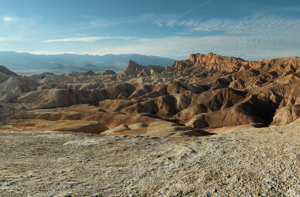
Zabriskie Point
Zabriskie Point is a dramatic natural feature in Death Valley, California, formed by sediment from an ancient lake, long since dried up. Named after the vice-president of the Pacific Coast Borax Company, it was made famous as the location of the love scene in Antonioni’s 1970 film, Zabriskie Point.
-
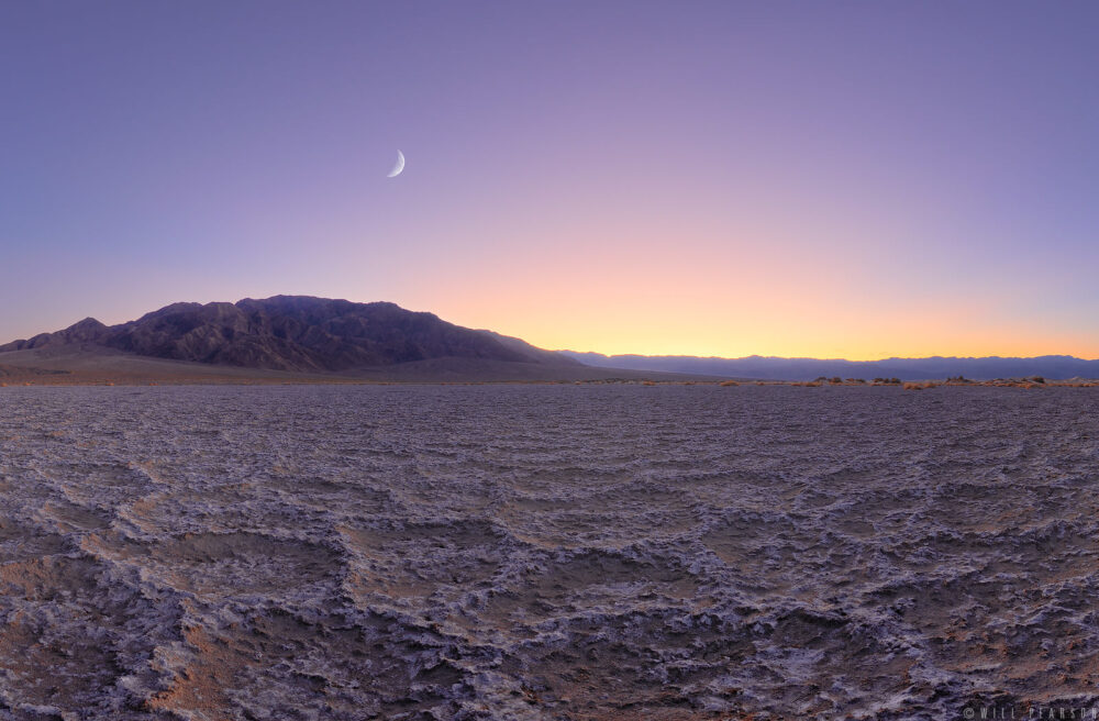
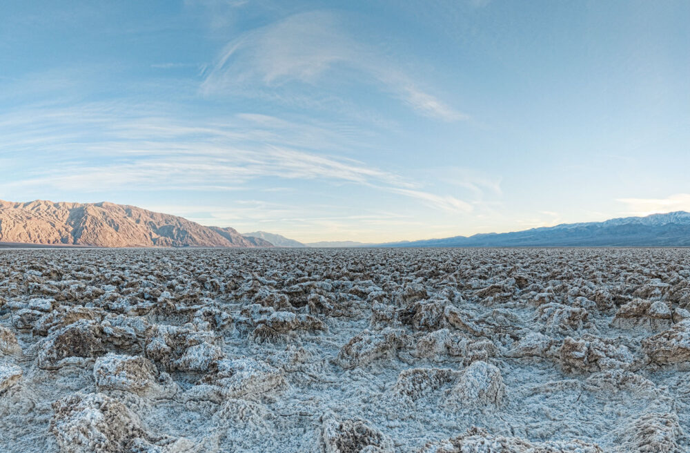
The Devil’s Golf Course, Death Valley
The Devil’s Golf Course is a huge area of of rock salt left behind when the lake which used to cover the area evaporated about 10,000 years ago. The rock salt has been formed by the elements into jagged peaks. The area was apparently named for a line in a 1930’s National Park Service Death…
-
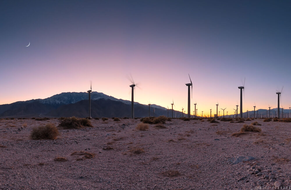
Wind Farm, Palm Springs
Driving down the Interstate 10 by Palm Springs, you come across the San Gorgonio Pass Wind Farm – a massive 4,000 windmill wind farm which generates enough energy for the Palm Springs area and the entire Coachella Valley. The area is a fantastic site for a wind farm as the pass between the San Bernardino…
-
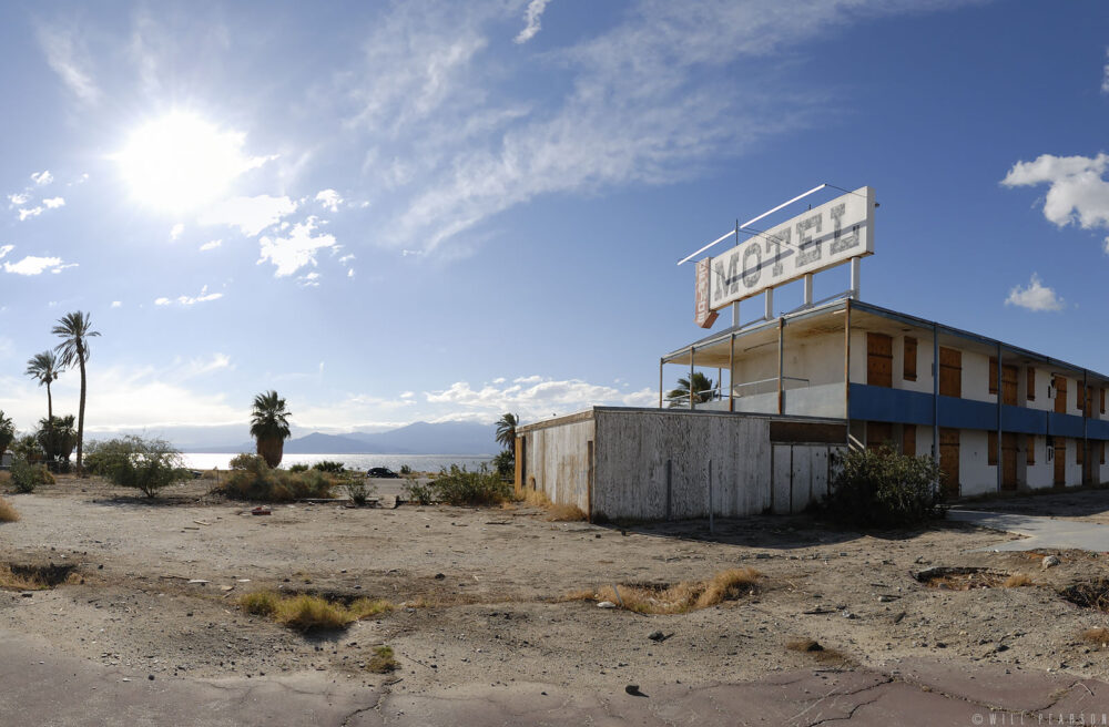
The Salton Sea, California
An accident in irrigation in 1905 led to the creation of the Salton Sea, a vast inland sea 69 metres below sea level in Southern California. The area became known for watersports, and after the introduction of fish to the sea, for sport fishing. By the 1950’s it was a thriving holiday destination with more…
-
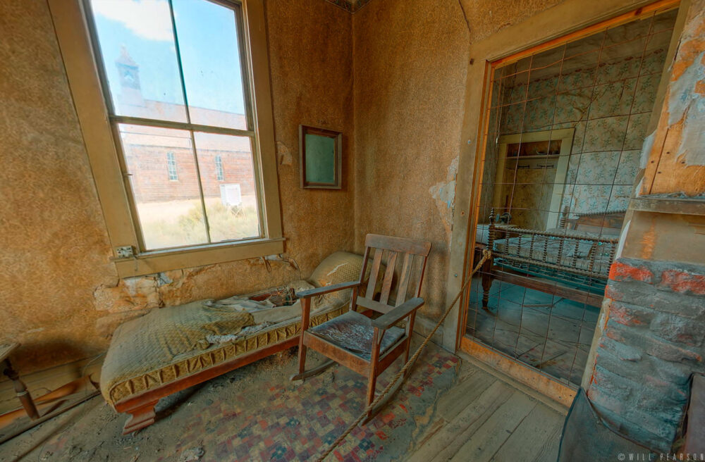
Bodie, California
Bodie was a gold rush town in the 1880’s and boomed to a population of 10,000 people, all hoping to make their fortune. Rumoured to have had 65 saloons, the town attracted miners, shopkeepers, newspapermen, prostitutes and gunslingers from all over America – and allegedly there was a man killed every day there.In the 1960’s,…
-
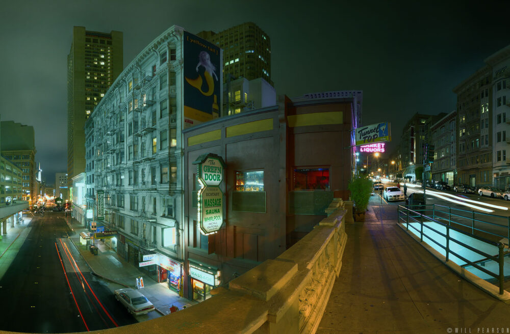
San Francisco, California, USA
A collection of virtual tours captured around San Francisco California. Including Union Square and the surrounding area.
-
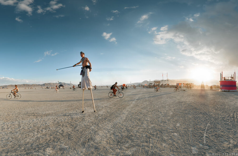
Black Rock City, Nevada
Each year, people from around the world gather to ‘burn the man’ deep in the Nevada Desert. A temporary city – Black Rock City – springs up to house all of these people, who are all exhorted to ‘leave no trace’ on the desert landscape. The Burning Man Festival is loosely, a festival of art,…
-
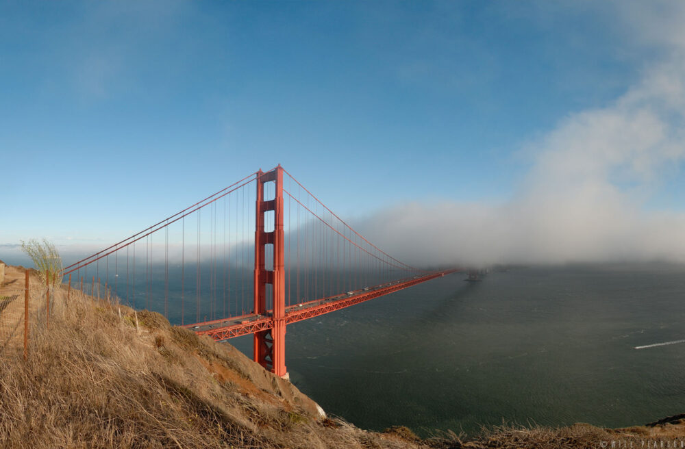
Golden Gate Bridge, San Francisco
At San Francisco Bay’s opening to the Pacific Ocean stands the Golden Gate Bridge. Finished in 1937, the distinctive red-orange colour was chosen to enhance its natural surroundings and to stand out in the fog. This virtual tour shows just how well that colour shows up against the fog rolling in.